
Axelspace
Founded Year
2008Stage
IPO | IPOTotal Raised
$110.91MDate of IPO
8/13/2025About Axelspace
Axelspace is a company that operates within the aerospace industry and focuses on microsatellite technology. The company has an earth observation platform service named 'AxelGlobe' and a microsatellite service called 'AxelLiner', which serve various sectors. Axelspace's clientele includes industries that require satellite imaging and data analytics. It was founded in 2008 and is based in Tokyo, Japan.
Loading...
Axelspace's Product Videos

Axelspace's Products & Differentiators
AxelGlobe
Earth observation platform for a new era. It will have the ability to image the whole civilized world with a resolution of 2.5 m every day.
Loading...
Research containing Axelspace
Get data-driven expert analysis from the CB Insights Intelligence Unit.
CB Insights Intelligence Analysts have mentioned Axelspace in 1 CB Insights research brief, most recently on Mar 1, 2024.
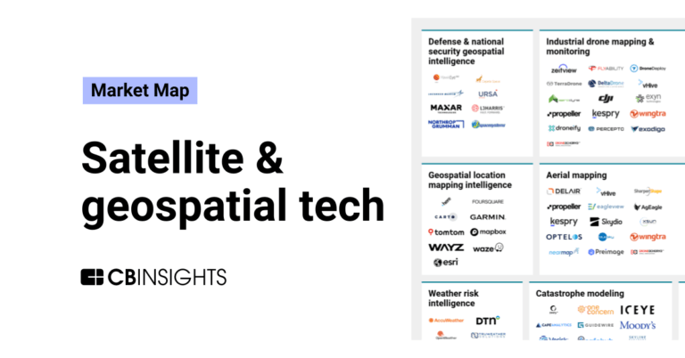
Mar 1, 2024
The satellite & geospatial tech market mapExpert Collections containing Axelspace
Expert Collections are analyst-curated lists that highlight the companies you need to know in the most important technology spaces.
Axelspace is included in 3 Expert Collections, including Conference Exhibitors.
Conference Exhibitors
5,302 items
Aerospace & Space Tech
4,993 items
Defense Tech
1,294 items
Defense tech is a broad field that encompasses everything from weapons systems and equipment to geospatial intelligence and robotics. Company categorization is not mutually exclusive.
Axelspace Patents
Axelspace has filed 3 patents.
The 3 most popular patent topics include:
- aircraft instruments
- artificial intelligence
- avionics
Application Date | Grant Date | Title | Related Topics | Status |
|---|---|---|---|---|
3/11/2021 | 9/20/2022 | Classification algorithms, Disability sport classifications, Machine learning, Statistical classification, Artificial intelligence | Grant |
Application Date | 3/11/2021 |
|---|---|
Grant Date | 9/20/2022 |
Title | |
Related Topics | Classification algorithms, Disability sport classifications, Machine learning, Statistical classification, Artificial intelligence |
Status | Grant |
Latest Axelspace News
Nov 11, 2025
WILMINGTON, DE, UNITED STATES, November 11, 2025 / EINPresswire.com / -- The satellite data services industry was valued at $12.8 billion in 2024, and is estimated to reach $69.7 billion by 2034, growing at a CAGR of 18.7% from 2025 to 2034. The growth of the global satellite data service market is primarily driven by the increasing adoption of Earth observation technologies across sectors such as agriculture, defense, environmental monitoring, and urban planning. Organizations are leveraging satellite data for applications such as crop health analysis, infrastructure development, and surveillance. The rise in need for accurate and real-time geospatial data for disaster response and climate change assessment is fueling demand. Technological advancements in high-resolution imaging, data analytics, and AI-powered processing are enhancing data usability. Furthermore, government investments in space programs and the growing number of private satellite launches are significantly boosting market expansion. Download Sample Pages of Research Overview: https://www.alliedmarketresearch.com/request-sample/A06428 The satellite data service market dominates due to its critical role in supporting various applications such as Earth observation, navigation, climate monitoring, and disaster management. Its ability to provide real-time, high-resolution data across vast and remote areas makes it indispensable for government, military, environmental, and commercial sectors globally. The satellite data services market is driven by the integration of advanced technologies such as artificial intelligence (AI), machine learning (ML), and big data analytics into satellite data processing. These tools enable faster, more accurate insights from large volumes of satellite imagery and telemetry, supporting applications in agriculture, climate monitoring, disaster response, and urban planning. For instance, in May 2024, Axelspace collaborated with Liberatech to integrate satellite data with AI analytics, aiming to deliver advanced Earth observation insights that support data-driven decision-making across various industries. Moreover, the increase in dependence on small satellites (smallsats) and low-Earth orbit (LEO) satellite constellations. These systems offer lower costs, shorter development cycles, and the ability to deliver high-resolution, near-real-time data, making satellite services more accessible to both public and private users. Buy This Research Report: https://www.alliedmarketresearch.com/satellite-data-services-market/purchase-options Furthermore, the commercialization of satellite data is also gaining momentum, with growing participation from private space companies and startups that offer tailored data solutions across industries such as oil and gas, defense, maritime, and environmental monitoring. Governments around the world are actively encouraging public-private partnerships and funding initiatives to expand the use of satellite data for national development goals and sustainability efforts. For instance, in February 2024, ArkEdge Space has partnered with SKY Perfect JSAT to accelerate the commercialization of micro-satellite constellations, aiming to enhance satellite data services industry by enabling faster, more efficient Earth observation and communication capabilities. Moreover, there is a rising demand for satellite-based connectivity in remote and underserved regions where traditional communication infrastructure is limited or unavailable. This growing need is driving the expansion of satellite data services, enabling reliable internet access, improved communication, and essential services in areas such as rural communities, disaster zones, and maritime locations. On the basis of region, the North America held the highest market share in 2024, accounting for around half of the satellite data service market revenue. This is due to the strong presence of major satellite operators, advanced technological infrastructure, and high government spending on defense and space programs. In addition, growing adoption of satellite data across sectors like agriculture, energy, and environmental monitoring further supports the region's dominant position in the global market. However, the Asia-Pacific region is projected to manifest the fastest CAGR of 22.33% from 2024 to 2034, This is due to rising investments in space programs, increasing demand for satellite-based services in agriculture, urban planning, and disaster management, and rapid technological advancements across emerging economies in the region. Enquiry Before Buying: https://www.alliedmarketresearch.com/purchase-enquiry/A06428 Leading Market Players: - L3Harris Technologies, Inc. Satellite Imaging Corporation Planet Labs Inc. SpecTIR Ursa Space Systems Inc. East View Geospatial ISI (ImageSat International) Maxar Technologies AIRBUS Trimble Inc. The report provides a detailed analysis of these key players of the global Satellite data service market size. These players have adopted different strategies such as expansion and product launch to increase their market share and maintain dominant shares in different regions. The report is valuable in highlighting business performance, operating segments, product portfolio, and strategic moves of market players to showcase the competitive scenario. Similar Reports: Satellite Image Data Services Market: https://www.alliedmarketresearch.com/satellite-image-data-services-market-A09064 Optical Satellite Market: https://www.alliedmarketresearch.com/optical-satellite-market-A325044 Reconnaissance Satellite Market: https://www.alliedmarketresearch.com/reconnaissance-satellite-market-A10669 David Correa Allied Market Research email us here Visit us on social media: LinkedIn Facebook YouTube X What Sets Us Apart ? - Allied Market Research Legal Disclaimer: EIN Presswire provides this news content "as is" without warranty of any kind. We do not accept any responsibility or liability for the accuracy, content, images, videos, licenses, completeness, legality, or reliability of the information contained in this article. If you have any complaints or copyright issues related to this article, kindly contact the author above.
Axelspace Frequently Asked Questions (FAQ)
When was Axelspace founded?
Axelspace was founded in 2008.
Where is Axelspace's headquarters?
Axelspace's headquarters is located at 3-3-3 Nihonbashi-Honcho, Chuo-ku, Tokyo.
What is Axelspace's latest funding round?
Axelspace's latest funding round is IPO.
How much did Axelspace raise?
Axelspace raised a total of $110.91M.
Who are the investors of Axelspace?
Investors of Axelspace include Fukoku Mutual Life Insurance Company, JGC MIRAI Innovation Fund, ANA Holdings, Global Brain, SMBC Venture Capital and 33 more.
Who are Axelspace's competitors?
Competitors of Axelspace include ArkEdge Space and 6 more.
What products does Axelspace offer?
Axelspace's products include AxelGlobe and 1 more.
Loading...
Compare Axelspace to Competitors

Maxar Technologies is a company focused on geospatial intelligence and space systems within the aerospace and defense industry. It offers high-resolution satellite imagery, AI-powered software for geospatial insights, and spacecraft platforms for various applications. Maxar Technologies primarily serves sectors such as national security, defense, civil government, and commercial industries. It was founded in 1969 and is based in Westminster, Colorado.

EOS Data Analytics provides satellite imagery analytics for the agriculture and forestry sectors. The company utilizes satellite data and artificial intelligence (AI) technologies to analyze the health of crops and forests. It serves the agriculture and forestry industries with its geospatial data analytics products. EOS Data Analytics was formerly known as Earth Observing System. It was founded in 2015 and is based in Mountain View, California.

Ursa Space specializes in satellite intelligence infrastructure, focusing on the collection and analysis of synthetic aperture radar (SAR) and optical imagery for various sectors. The company offers a catalog of SAR images and provides services for monitoring changes on Earth, analyzing data to understand patterns and behaviors, and delivering findings through platforms. Ursa Space primarily serves sectors such as global security, economic analysis, maritime activities, and infrastructure monitoring. It was founded in 2014 and is based in Ithaca, New York.

ICEYE focuses on synthetic aperture radar (SAR) satellite operations within the Earth observation space. The company offers Earth imagery and monitoring capabilities for sectors such as insurance, government, and defense. ICEYE's services assist in natural catastrophe response, risk assessment, and surveillance, independent of weather conditions. It was founded in 2015 and is based in Espoo, Finland.
Skylab Analytics provides geospatial analytical solutions within the technology sector. The company offers services including analysis and modeling, satellite imagery analysis, custom mapping dashboards, and the integration of artificial intelligence and machine learning into business operations. Skylab Analytics serves sectors that require data insights, such as agriculture, energy distribution, and renewable energy production. It is based in Holland, Netherlands.

Teren serves as an aerial asset management company specializing in remote sensing, photogrammetry, data management, and data visualization. Its software as a service (SaaS) platform is tailored to clients and customers in the construction and environmental industries. Its principal focus is capturing and documenting the life cycle of infrastructure projects and surveying for project-specific variables that inform project management decisions. Teren was formerly known as SolSpec. The company was founded in 2021 and is based in Lakewood, Colorado.
Loading...